
15 Market Street
Atherstone
CV9 1ET
Atherstone
Guide Price £285,000
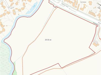
Land
- Approximately 25.32 acres of pastureland
- Road frontage to the A5
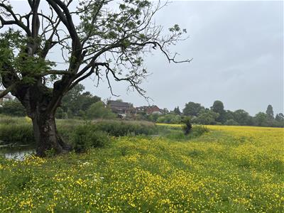
- Frontage to the River Anker
- Wildlife/amenity/habitat potential/BNG
A rare opportunity to acquire approximately 25.32 acres of attractive pastureland with road and river frontage
Distances
Atherstone: 1 mile
Nuneaton: 4 miles
Market Bosworth: 7 miles
Hinckley: 7 miles
Tamworth: 8 miles
Location
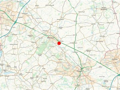
The land has direct vehicular access off Watling Street (A5), situated on the eastern edge of the village of Mancetter. There is also pedestrian access from Mancetter, via a footbridge across the river.
Mancetter is a historic village approximately 1 mile from the market town of Atherstone, which provides a range of local amenities and services. The local area has excellent connectivity to the wider road network, including the M42 and M6 Toll, with the larger centres of Nuneaton and Tamworth also readily accessible.
Description
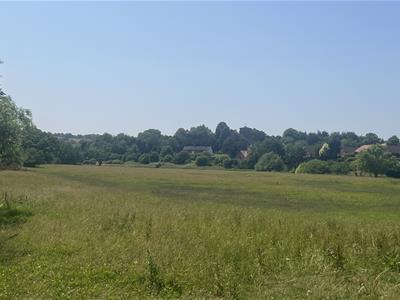
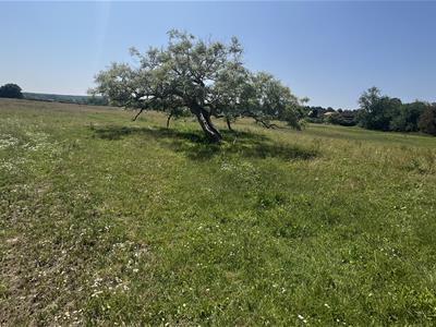
The land comprises approximately 25.32 acres of gently undulating pasture land with frontage to the River Anker.
The land is enclosed by a combination of mature hedges and post-and-wire fencing, with a partial ditch and hedgerow running through the land on a north-east to west alignment, marking the division between the two original fields. Approximately two thirds of the land is located within a Scheduled Ancient Monument relating to the Manduessedum Roman Villa and Settlement and associated industrial complex.
The land is predominantly open in character and is well suited to cattle or sheep grazing, potential mowing for hay and also has equestrian potential. The seller has had a Biodiversity Net Gain (BNG) baseline assessment carried out on the land by ecology consultants Brindle & Green, which concluded that the site had significant opportunities for habitat enhancement and the generation of BNG units and strong potential to function as a strategic habitat bank. The extent of the BNG potential would be subject to further ecological assessment.
Services
We understand that the land does not benefit from any mains services. Purchasers should make their own enquiries as to the availability and adequacy of services.
Fishing Rights
The extent of any sporting and fishing rights included in the sale is to be confirmed.
Tenure and Possession
Freehold with vacant possession upon completion.
Scheduled Ancient Monument
For more information visit https://historicengland.org.uk/listing/the-list/ (listing entry no. 1017585)
Method of Sale
The land will be sold by private treaty.
Local Authority
North Warwickshire Borough Council
https://www.northwarks.gov.uk/
Tel:01827-715341
Easements, Wayleaves and Rights of Way
There is a public footpath over the land as shown by the dotted orange line on the plan. The land is sold subject to and with the benefit of any easements, wayleaves and rights of way that may exist at the time of sale, whether disclosed or not.
Viewing
At any time during daylight hours with a copy of these particulars to hand.
Flood Plain
Approximately one-third of the land is identified as being within Flood Zone 3. The area identified as Flood Zone 3 broadly follows the course of the River Anker along the field boundary, predominantly affecting the western part of the land.
Contact Details
Daisy Carroll - Tel:01827-721380
Susannah Bennion: Tel:01827-721380
Plan, Area and Description
The plan, area and description are believed to be correct in every way, but no claim will be entertained by the vendor or the agents in respect of any error, omissions or misdescriptions. The plan is for identification purposes only.
Anti-Money Laundering
To enable us to comply with the Money Laundering Regulations we need to verify the buyer’s identity before proceeding with a sale. We charge a small administration fee for conducting an electronic AML verification check via our online provider, MoveButler.
What3Words
///swimmer.recount.rainwater
Although these particulars are thought to be materially correct their accuracy cannot be guaranteed and they do not form part of any contract.
Property data and search facilities supplied by www.vebra.com