16 Terrace Road
Aberystwyth
Ceredigion
SY23 1NP
Ysbyty Ystwyth, Aberystwyth
Guide price £225,000 Sold (STC)
Land
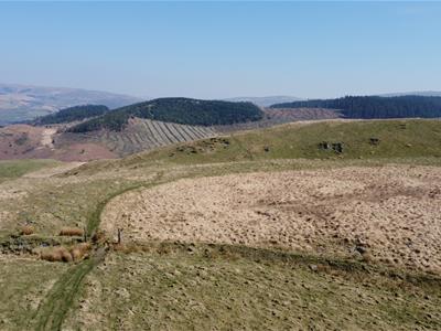
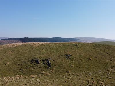
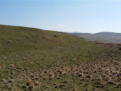
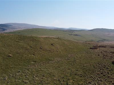
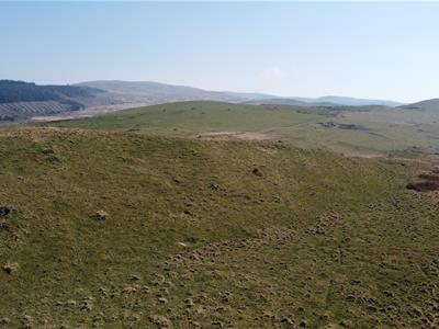
A useful parcel of improved and unimproved land amounting to 78 acres situated about 350 metres above sea level
(EER N/A)
TENURE - Freehold
COUNCIL TAX (N/A)
FOR SALE BY PRIVATE TREATY
A useful parcel of improved and unimproved land amounting to 78 acres situated about 350 metres above sea level known as
LAND ADJ PANT Y FFYNNON and PENLAN FEDWEN
YSBYTY YSTWYTH
ABERYSTWYTH
CEREDIGION
SY25 6DG
The land is approached over a council-maintained road from Ysbyty Ystwyth which provides access to the B4343 Pontrhydygroes to Pontrhydfendigaid road. Limited local amenities are available at the nearby villages to include a primary school and village shop to the South at Pontrhydfendigaid. The university and market town of Aberystwyth is approximately 16 miles traveling distance on the coast and the market town of Tregaron is some 11 miles to the South. Both the aforementioned towns have a good range of amenities to include secondary schools.
DIRECTIONS
(OS Grid Ref: SN75169 71567)
WHAT3WORDS – bless.noble.beakers
Take the A487 South to Southgate, turn left on to the A4120 Devils Bridge road and turn immediately right onto the B4340 Pontrhydfendigaid road. At Abermagwr take the first turning left to Ponthrydygroes (signposted). At the village turn right at the T junction and proceed over the bridge for a mile to Ystbyty Ystwyth. Turn left near the church and proceed up the hill. Take the 2nd turning right and proceed to the very end of the road to the land.
LAND REGISTRY
The land is registered on Title Number CYM624719 and WA 618168
GRAZING RIGHTS
There are rights for 200 ewes(approx.) included in the sale. Reference Common register.
CL46 Entry No 5 (Part of 1000 rights)
CL49 Entry No 8 (Part of 1000 rights)
DESCRIPTION
The majority of the land is accessible with some areas of improved grazing which will be evident on inspection. There is a pond on the western boundary as highlighted on the plan and the land is high on conservation value.
The land in total amounts to 78.1 acres or thereabouts and is well worthy of inspection.
The Borth, Devils Bridge and Pontrhydfendigaid trail runs adjacent to the Eastern boundary and there are several other public footpaths that cross the land.
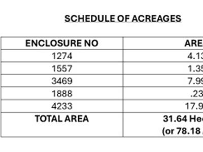
SCHEDULE OF ACREAGES
OS PLAN
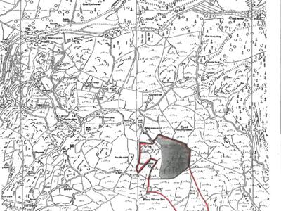 A plan of the land highlighting the boundaries in red are included with the particulars for identification purposes only.
Although these particulars are thought to be materially correct their accuracy cannot be guaranteed and they do not form part of any contract.
Property data and search facilities supplied by www.vebra.com