15 Market Street
Atherstone
CV9 1ET
Spinmey Farm, Elmesthorpe, LE9
Guide Price £650,000
Land
- 51.68 acres of permanent pastureland
- Agricultural buildings with potential for alternative uses (subject to gaining the necessary planning consents)
- Grade 3 land
- Freehold with vacant possession upon completion
- Adjacent to draft housing allocation
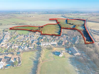
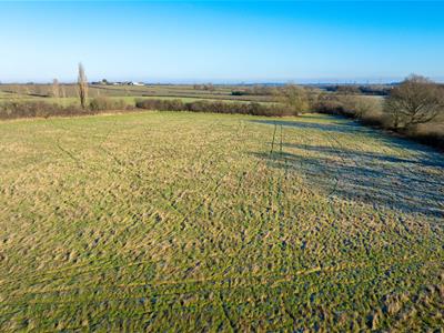
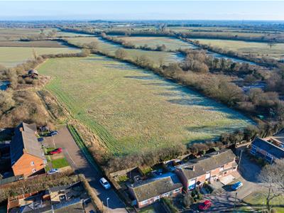
Approximately 51.68 acres of permanent pastureland, split into six enclosures, with potential for development
Description
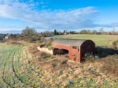
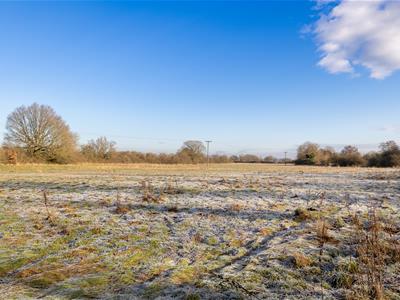
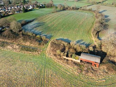
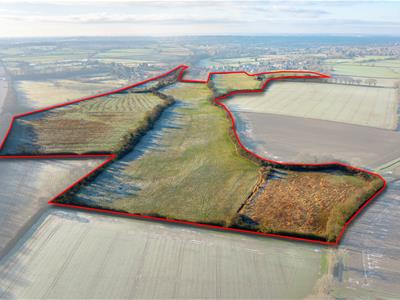
The property extends to approximately 51.68 acres of permanent pastureland, split into six enclosures, with a 15m x 7.5m Dutch barn and a dilapidated brick and tile building of approximately 80sq.m. The buildings may have potential for conversion to residential or commercial uses, subject to gaining the necessary planning consents.
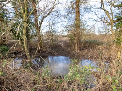
The land is generally flat and level with a gentle slope down towards the watercourse which runs through the middle. The land is classified as Grade 3 on the Agricultural Land Classification Map and according to the Soil Map of England and Wales, the soil is a loamy clayey soil of the Whimple 3 series.
We understand that the majority of the land has been grazed and cut for hay in the past, although not in the 2024 season.
The land lies in Blaby District. The land to the immediate north of the farm is in the Hinckley and Bosworth District and has been identified in their emerging Local Plan as a potential site for up to 2,000 houses.
The land may also be suitable for Biodiversity Net Gain, tree planting or other environmental uses, either instead of or alongside agriculture or development.
Location
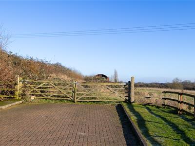
The land is situated on the edge of the village of Elmesthorpe, approximately 1.5 miles to the south of Earl Shilton and 4 miles to the northeast of Hinckley. Access to the land is off Spinney Farm Close via The Roundhills from the B581 Station Road.
Junction 2 of the M69 is approximately 3.5 miles to the south, providing convenient access to the A5, M1 and further afield.
Local Authority
Blaby District Council
www.blaby.gov.uk
Services
We understand that the buildings are connected to mains water and electricity. Purchasers should make their own enquiries as to the availability and adequacy of services.
Method of Sale
The property will be sold by private treaty.
Overage Clause
The property will be sold with an overage clause which will reserve 30% of any uplift in value attributed to any change of use or planning permission on the land for a period of 30 years. For the avoidance of doubt, the overage clause will not be triggered by any agricultural, private equestrian or forestry uses.
Easements, Wayleaves and Rights of Way
Access to the land is via a right of way over Spinney Farm Close, shown by the blue dotted line on the sale plan.
There is a public footpath which crosses over a small section of the land, shown by the green dotted line on the sale plan.
The land is sold subject to and with the benefit of any easements, wayleaves and rights of way that may exist at the time of sale, whether disclosed or not.
Tenure and Possession
Freehold with vacant possession upon completion.
What3words
///foot.oatmeal.kicked
Viewing
The land may be viewed during reasonable daylight hours on foot by anyone in possession of a copy of these particulars. If you would like to drive around the site, please contact James Collier or Susannah Leedham on tel:01827-721380 option 3
Plan, Area and Description
The plan, area and description are believed to be correct in every way, but no claim will be entertained by the vendor or the agents in respect of any error, omissions or misdescriptions.
The plan is for identification purposes only.
Anti-Money Laundering
Under the Money Laundering Directive (S12017/692) we are required to take full identification (e.g., photo ID and recent utility bill as proof of address) when a purchaser submits an offer for a property. Please be aware of this and have the information available.
Please note a fee of £30 will be charged to each buyer for the Anti-Money Laundering check via our online system Move Butler.
Contact
Please contact the Atherstone office for further information
Although these particulars are thought to be materially correct their accuracy cannot be guaranteed and they do not form part of any contract.
Property data and search facilities supplied by www.vebra.com